Download free Safe download (395.51 MB)
9 downloads (last 7 days)
Organize all the information you need inside your maps.
Review by Benjamin S.
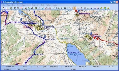
This powerful program can serve us both to orient ourselves and to locate ourselves to move from one place to another. It is also very useful if we want to give it a pedagogic function. Within what is the discipline of geography, cartography is very important because when we look to a map we can see which region is to assess other environmental data and geographical level that we can have from it. Maps are an important resource for any type of education related to geography. To do this, OkMap will be the best tool as we have all the maps we want completely available with excellent definition and all the signs that it can be added to it and displayed to any particular point.
With this tool, the user will be able to build its own maps adding the information that he does not find and even, users will be able to mark points to have a clear reference of what they want to see or search. On the other side, users will be able to make the maps by importing or exporting different data in different formats, as well as the map itself if all are in one of the formats that are accepted by this program: WPT, PLT, RTE, LOC, DEM, HGT , ECW, BMP, TIF, GFW, JGW, PGW, TFW, BPW, ECW, MAP, GMI, SHP, DBF, DCW, GPX, KML or in the most popular ones: GIF, JPG, PNG.
With this tool, the user will be able to build its own maps adding the information that he does not find and even, users will be able to mark points to have a clear reference of what they want to see or search. On the other side, users will be able to make the maps by importing or exporting different data in different formats, as well as the map itself if all are in one of the formats that are accepted by this program: WPT, PLT, RTE, LOC, DEM, HGT , ECW, BMP, TIF, GFW, JGW, PGW, TFW, BPW, ECW, MAP, GMI, SHP, DBF, DCW, GPX, KML or in the most popular ones: GIF, JPG, PNG.
Restrictions
- ECW maps cannot be opened.
- Map georeferencing is limited to two points.
- GPX data cannot be saved.
- Download DEM data is not included.
- Map tiling is not included.
- The calculation of travel time is not included.
- GPS send/receive funcions are not included.
- Google Maps/Earth integrations are not included.
- Map server function is not included.
- Creation of photos and toponyms are not included.
- Coordinates conversions are not included.
- Send/receive OkMap/GpsGate functions are not included.
- Track grid generation is not included.
- XSL transformations are not included.
Additional details
Size
395.51 MB
Latest version
17.6.1
Language
English
Total Downloads
4,694
Alternatives to OkMap
Popular
Earth globe with a lot of puzzles for all the states of the world ot only with the states of the USA.


